Normandy: Sword, Juno, and Gold Beaches
After visiting Douvre we drove toward the beach. This was eastern flank of the invasion so we were in the area of Sword beach. From east to west the beaches were named Sword, Juno, Gold, Omaha, and Utah. They were fought by nations in this order repectively, English, Canadian, English, US, US.
The first town we encountered was Saint Aubin sur Mer, a small French resort town. Though the weather was not spectacular and it was out of season there were a few people out enjoying the day on the beach. Families exploring tide pools, children digging in the sand, people in wind driven sail-carts. This was Sword beach that in 1944 was smothered in furious noise, fear, and carnage. The contrast must strike everyone one and as Eisenhower said in some similar location 20 years after the invasion this was what they fought for, peaceful, civil, mundane, life.
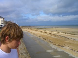
The seawall at Sword Beach Saint Aubin sur Mer
Here there wasn't much evidence of the war except a small monument at the parking lot and this gun emplacement. If you look carefully you will notice it opens inland with its back wall to the sea. This provided protection from the big naval guns. The guns could point down the beach at an angle and these stations were arranged to provide overlapping enfilading fire (You can click on the link to learn more on Wikipedia.) rather than direct frontal fire on an invasion.
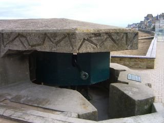
A 50mm German Gun (notice it has its back to the sea)
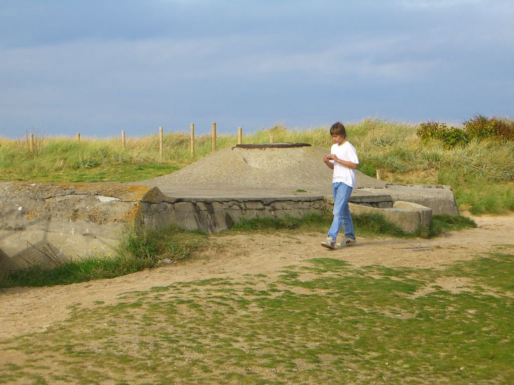
Next we drove down to Coursuelles sur Mer which marks Juno beach where the Canadians fought. There is a small port there, fortifications, and a museum. The fortifications didn't make any sense until one realized the beach and dunes had moved substantially and that many of the defenses were now too far inland.

A DD (duplex drive) Tank at Juno beach used in the invasion
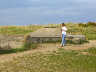
Redington takes pictures of a Juno beach defensive installation
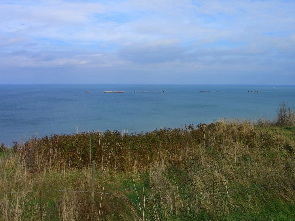
We drove further on toward Gold beach past Hamel Asnelles to a bluff above Arromanches, a key town for the British to capture. Arromanches became one of the key towns because the British built an artificial harbor using floated sections that were sunk in place called Mulberries. (You can click on the link to learn more on Wikipedia.) The name Mulberry was apparently an arbitrary military code name as other harbors were called Gooseberry and Corn Cob.
I used Google Earth to give an aerial view of Arromanches to make more sense of the photos I took. Here you can see the town of Arromanches and the caissons used to make the harbor.

Google Earth view of Arromanches harbor

Looking back at Hamel Asnelles
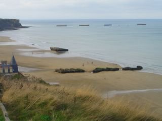
In these pictures you can see the line of caissons used to construct the mulberries; above is the far eastern edge.

A line of caissons forming the middle of the harbor. (click to enlarge)
Looking toward Arromanches and the west end of the harbor.
From here we hiked down the bluff to the town of Arromanches.
Washed up dock parts on the beach
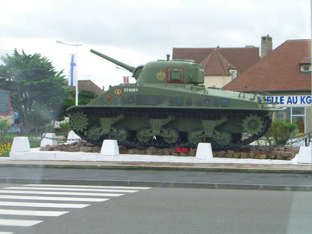
It was on this beach that the small army of the Free French forces landed to retake their country. The tank pictured below was a monument to them. In Stephen Ambrose's book he relates a story of one of the French Free Forces veterns who landed at the beach of his home town and helped liberate it and has lived there ever since.

A tank used by the French Free forces

Redington with an anti-aircraft gun
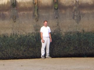
Me in front of the huge dock section on the beach.
Here is a Google Earth view of the dock pieces shown above. The aerial photo was taken at high tide.

Here are the Arromanches dock remants from Google Earth
The first town we encountered was Saint Aubin sur Mer, a small French resort town. Though the weather was not spectacular and it was out of season there were a few people out enjoying the day on the beach. Families exploring tide pools, children digging in the sand, people in wind driven sail-carts. This was Sword beach that in 1944 was smothered in furious noise, fear, and carnage. The contrast must strike everyone one and as Eisenhower said in some similar location 20 years after the invasion this was what they fought for, peaceful, civil, mundane, life.

The seawall at Sword Beach Saint Aubin sur Mer
Here there wasn't much evidence of the war except a small monument at the parking lot and this gun emplacement. If you look carefully you will notice it opens inland with its back wall to the sea. This provided protection from the big naval guns. The guns could point down the beach at an angle and these stations were arranged to provide overlapping enfilading fire (You can click on the link to learn more on Wikipedia.) rather than direct frontal fire on an invasion.
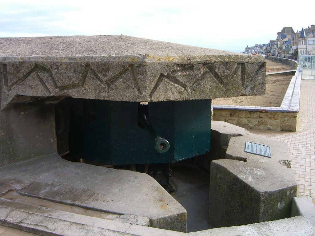
A 50mm German Gun (notice it has its back to the sea)
Next we drove down to Coursuelles sur Mer which marks Juno beach where the Canadians fought. There is a small port there, fortifications, and a museum. The fortifications didn't make any sense until one realized the beach and dunes had moved substantially and that many of the defenses were now too far inland.
A DD (duplex drive) Tank at Juno beach used in the invasion
Redington takes pictures of a Juno beach defensive installation
We drove further on toward Gold beach past Hamel Asnelles to a bluff above Arromanches, a key town for the British to capture. Arromanches became one of the key towns because the British built an artificial harbor using floated sections that were sunk in place called Mulberries. (You can click on the link to learn more on Wikipedia.) The name Mulberry was apparently an arbitrary military code name as other harbors were called Gooseberry and Corn Cob.
I used Google Earth to give an aerial view of Arromanches to make more sense of the photos I took. Here you can see the town of Arromanches and the caissons used to make the harbor.

Google Earth view of Arromanches harbor

Looking back at Hamel Asnelles
In these pictures you can see the line of caissons used to construct the mulberries; above is the far eastern edge.
A line of caissons forming the middle of the harbor. (click to enlarge)

Looking toward Arromanches and the west end of the harbor.
From here we hiked down the bluff to the town of Arromanches.

Washed up dock parts on the beach
It was on this beach that the small army of the Free French forces landed to retake their country. The tank pictured below was a monument to them. In Stephen Ambrose's book he relates a story of one of the French Free Forces veterns who landed at the beach of his home town and helped liberate it and has lived there ever since.

A tank used by the French Free forces

Redington with an anti-aircraft gun
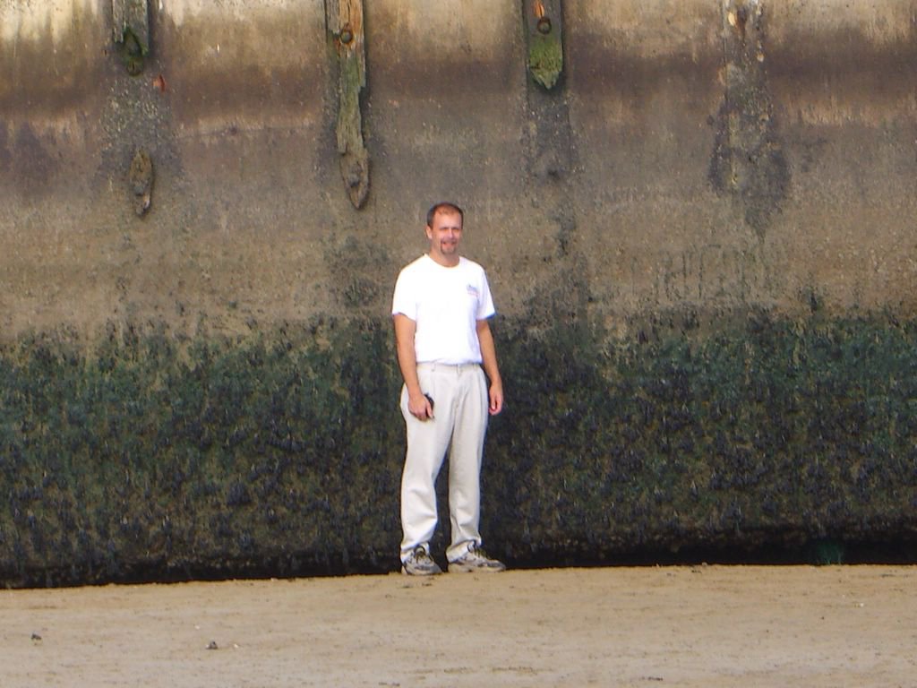
Me in front of the huge dock section on the beach.
Here is a Google Earth view of the dock pieces shown above. The aerial photo was taken at high tide.
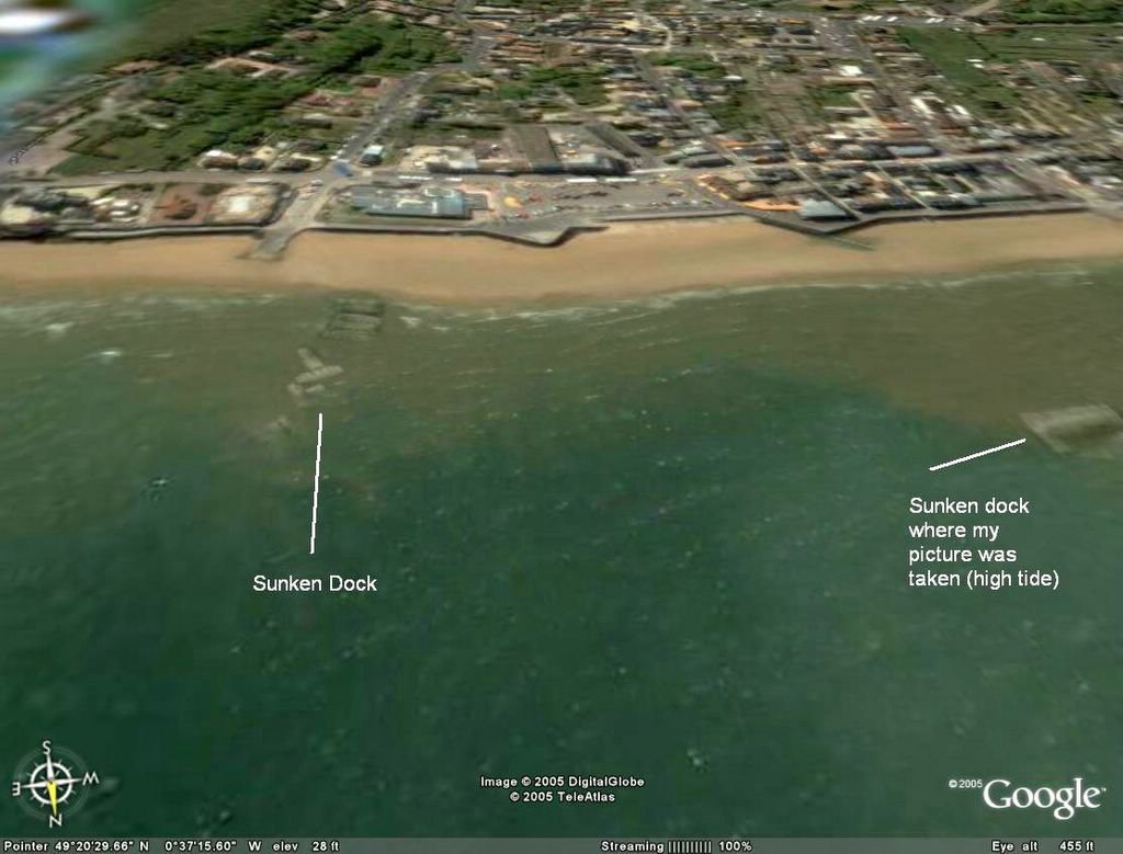
Here are the Arromanches dock remants from Google Earth
Comments