Neahkahnie Mountain Hike
Last Saturday the weather was so nice that after skeet shooting with Bob and Randy I decided to pack up and go hiking on the coast. I hadn't been out in a while and we don't often get this kind of clear (though cold) weather this time of year. An hour later I was on the road heading west on highway 26 to highway 6 toward Tillamook. I was heading for Neahkahnie mountain on a rugged stretch of the coast between Tillamook and Cannon Beach. I had read some time ago about this hike and recall it was described as strenuous.
It took about an hour of driving to reach Tillamook and Tillamook bay. Here several major coastal rivers run to the sea including the Wilson, Trask, and Tillamook rivers. Tillamook is a dairy community famous for the cheese factory there.
The bay was calm this afternoon and the weather shockingly warm. In Hillsboro it was probably about 45 degrees but here it was at least 65 degrees.

Calm on Tillamook Bay
Closer to the mouth of the bay where it opens to the Pacific Ocean is one of my favorite places. The trees on the rocks give a bonsai appearance. Many times I have seen Bald Eagles in the trees here beside the road.

Tillamook Bay near Garibaldi
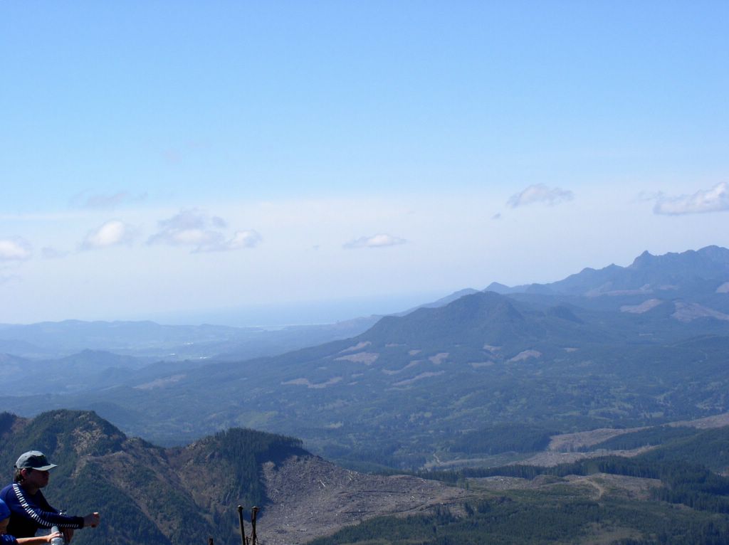
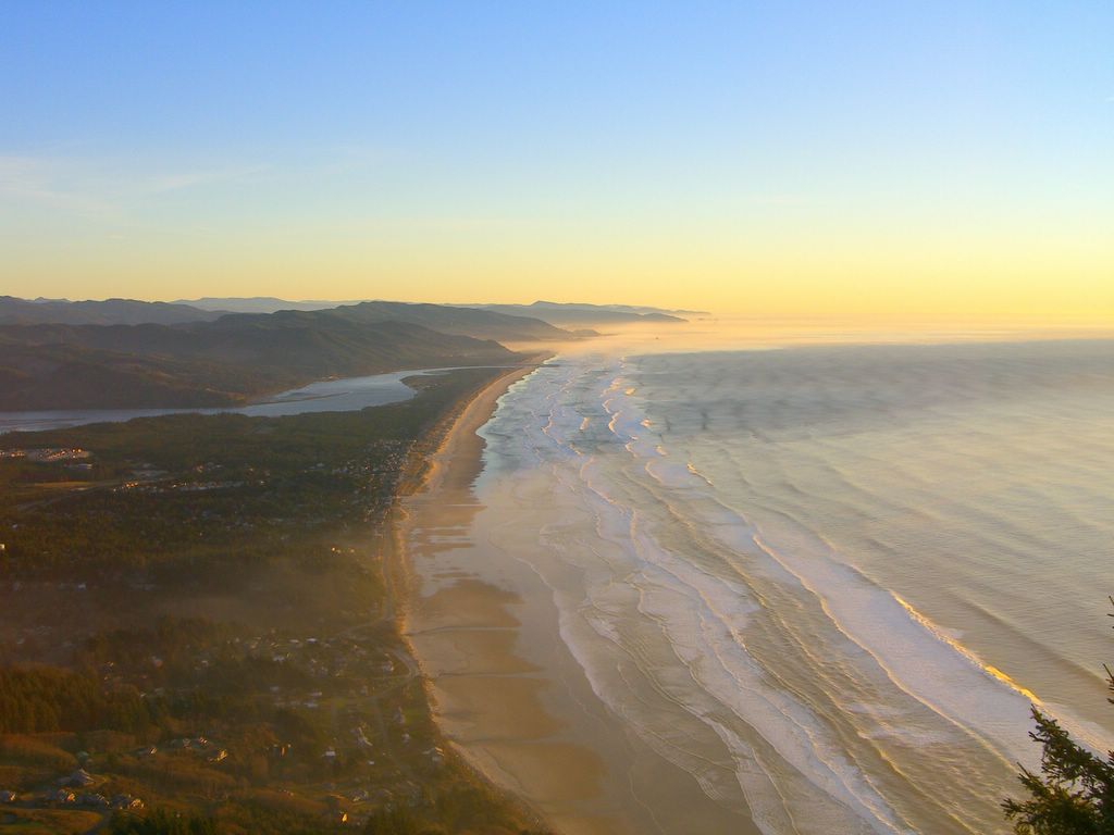
Further north on highway 101 the highway swings around Nehalem bay where the Nehalem river runs to the ocean. The Nehalem is the largest coastal river in Oregon and with its circuitous route in the northwest corner of the state drains a vast area of the coastal forest. Here I snapped a picture of Saddle Mountain. Vicki, Redington, and I hiked there this last summer in a dense fog that gave us no view at all. The next picture however is one I took from the top of Saddle mountain April 27th 2003. Here you can see Nehalem bay near the center and Neahkahnie mountain to the right of the bay (click to enlarge).

Saddle Mountain from Nehalem Bay

Nehalem Bay as seen from Saddle Mountain
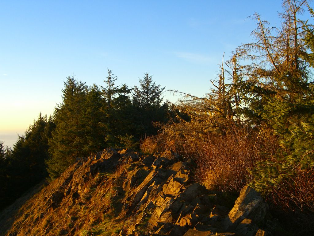
The hike up Neahkahnie mountain is a short set of switch backs (about 2 miles). Another shorter hike up a well traveled but unsanctioned route gets one to the very top for spectacular views. Here is the view to the south down the coast and Nehalem Bay.

South along the Coast and Nehalem Bay

Angora mountain to the North

Looking West from the top

Looking East over the ridge towards the coast range
The coast guard has a benchmark I discovered when I sat down. Part of the reason for the trip was to create a geocache. I hadn't placed one in a couple of years so before I left I assembled some small items in a tupperware container and left them near the summit. I then used my GPS to record the locations and after I got back I registered the location on the geocache website. Already one person has discovered it. You can checkout geocaching here.

Benchmark at Neahkahnie
Getting to the top around 4:30 I couldn't resist staying for the sunset. As soon as the sun set the wind rose and it got cold very quickly. This is one of those kinds of places that makes me feel like I am on top of the globe of earth.
After the sun was down I hiked in the dark back to my truck and drove to Nehalem Bay State park to a campground.

Sunset from Neahkahnie
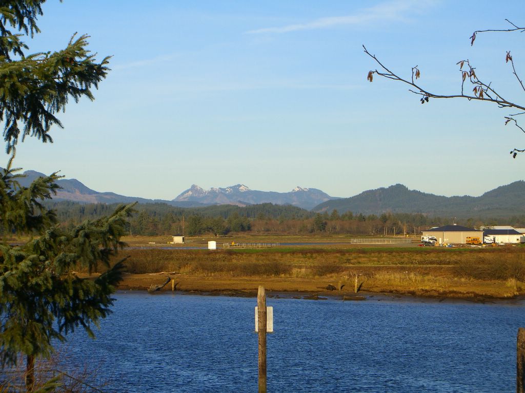
The next morning I woke up at Nehalem Bay State Park it was cold and windy though sunny. My dad and I had camped here a couple of years ago when we spent a few days fishing for Fall Chinook Salmon. We didn't have much luck at the time but I sure enjoyed fishing with him.

Camping with Karl
Here is my truck Karl with my camping supplies out as I prepare breakfast. Redington will remember everything here as we have camped together all over the Western US and Canada like this. I remember him especially when I go camping. He is a great camping companion.
I took a walk on the beach after breakfast. Here is Neahkahnie mountain with the top obscured by an odd cloud.

Neahkahnie from the beach
It took about an hour of driving to reach Tillamook and Tillamook bay. Here several major coastal rivers run to the sea including the Wilson, Trask, and Tillamook rivers. Tillamook is a dairy community famous for the cheese factory there.
The bay was calm this afternoon and the weather shockingly warm. In Hillsboro it was probably about 45 degrees but here it was at least 65 degrees.
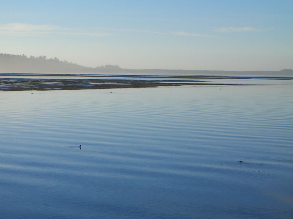
Calm on Tillamook Bay
Closer to the mouth of the bay where it opens to the Pacific Ocean is one of my favorite places. The trees on the rocks give a bonsai appearance. Many times I have seen Bald Eagles in the trees here beside the road.
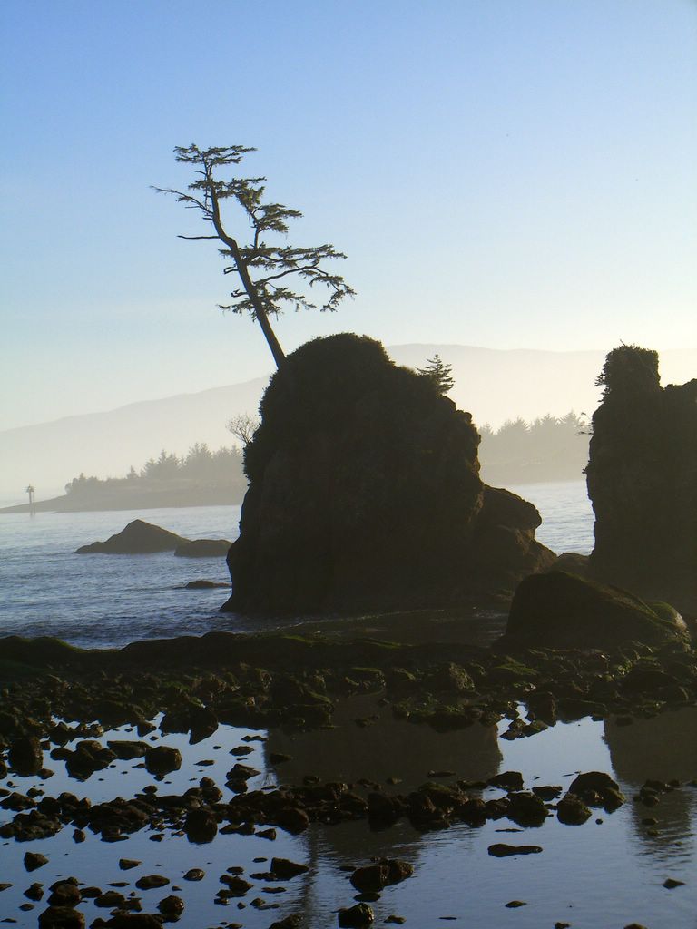
Tillamook Bay near Garibaldi
Further north on highway 101 the highway swings around Nehalem bay where the Nehalem river runs to the ocean. The Nehalem is the largest coastal river in Oregon and with its circuitous route in the northwest corner of the state drains a vast area of the coastal forest. Here I snapped a picture of Saddle Mountain. Vicki, Redington, and I hiked there this last summer in a dense fog that gave us no view at all. The next picture however is one I took from the top of Saddle mountain April 27th 2003. Here you can see Nehalem bay near the center and Neahkahnie mountain to the right of the bay (click to enlarge).
Saddle Mountain from Nehalem Bay
Nehalem Bay as seen from Saddle Mountain
The hike up Neahkahnie mountain is a short set of switch backs (about 2 miles). Another shorter hike up a well traveled but unsanctioned route gets one to the very top for spectacular views. Here is the view to the south down the coast and Nehalem Bay.
South along the Coast and Nehalem Bay
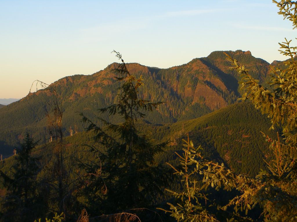
Angora mountain to the North
Looking West from the top

Looking East over the ridge towards the coast range
The coast guard has a benchmark I discovered when I sat down. Part of the reason for the trip was to create a geocache. I hadn't placed one in a couple of years so before I left I assembled some small items in a tupperware container and left them near the summit. I then used my GPS to record the locations and after I got back I registered the location on the geocache website. Already one person has discovered it. You can checkout geocaching here.

Benchmark at Neahkahnie
Getting to the top around 4:30 I couldn't resist staying for the sunset. As soon as the sun set the wind rose and it got cold very quickly. This is one of those kinds of places that makes me feel like I am on top of the globe of earth.
After the sun was down I hiked in the dark back to my truck and drove to Nehalem Bay State park to a campground.
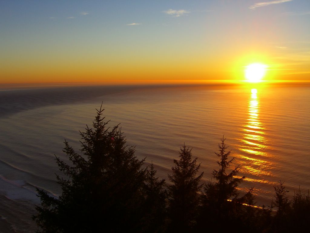
Sunset from Neahkahnie
The next morning I woke up at Nehalem Bay State Park it was cold and windy though sunny. My dad and I had camped here a couple of years ago when we spent a few days fishing for Fall Chinook Salmon. We didn't have much luck at the time but I sure enjoyed fishing with him.
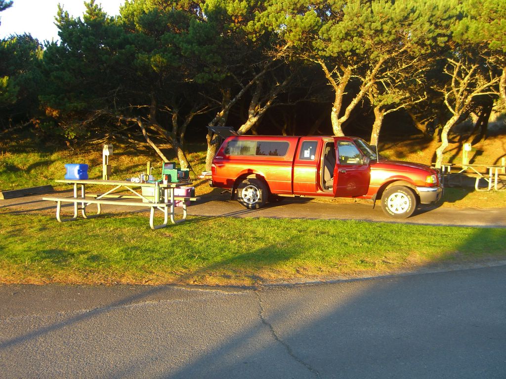
Camping with Karl
Here is my truck Karl with my camping supplies out as I prepare breakfast. Redington will remember everything here as we have camped together all over the Western US and Canada like this. I remember him especially when I go camping. He is a great camping companion.
I took a walk on the beach after breakfast. Here is Neahkahnie mountain with the top obscured by an odd cloud.
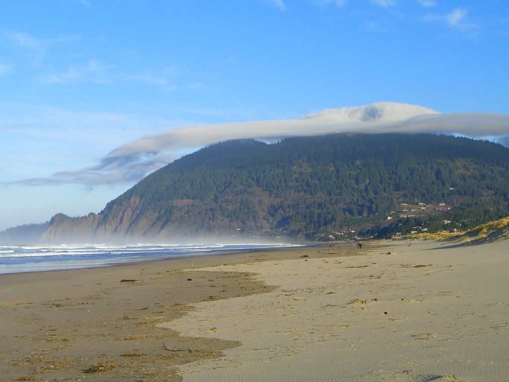
Neahkahnie from the beach
Comments