Larch Mountain Hike
On Saturday the 27th of August I decided to go for a hike. I had a business trip early the next morning so I tried to pack the weekend into one day. In the morning I had an upland game bird clinic with my instructor Bud McDougal at the Hillsboro Trap and Skeet Club. The clinic was to improve bird hunting skills for quail, pheasant, grouse, and chukkar. I took it to improve my shooting skills. It was challenging and after the two hour clinic I shot some skeet with some of the other students I met.
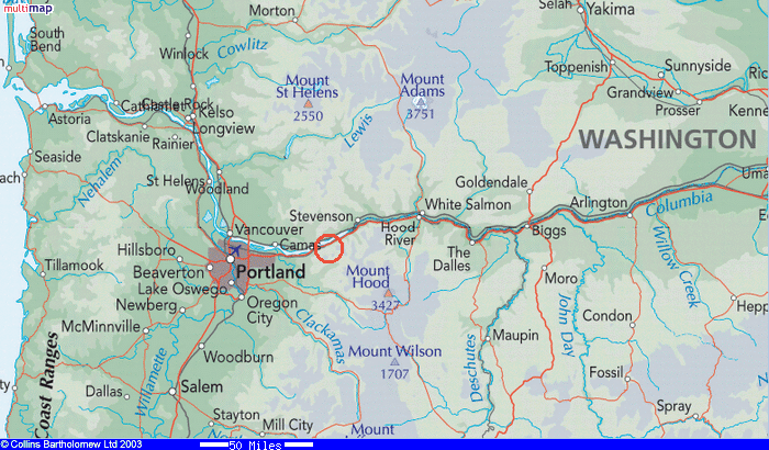
By the time I had lunch and drove out to the gorge it was a little after 3:00PM. I stopped at Oneonta trail head. The area is shown in the map above. The sign said Larch mountain 7.7 miles which was a little longer than I had planned. On the drive through Portland I called Redington in the UK and when he asked how long I planned to hike I said 6-8 miles. It was late and I did the math and realized it might be dark before I got back. I had a headlamp with me though.
 I drew the route on the topo map to the left in red. The altitude profile is shown below. (The map and profile may be clicked on to enlarge them.)
I have cycled up the other side of Larch mountain a number of times before. It is a rather famous bike ride in Portland due to its unrelenting climb. The road can be seen in black on the west slope of the mountain.

Larch Mountain is almost 4000 Ft in altitude. The climb is gentler than Mt Defiance owing to the longer distance 7.7 vs 5 miles and lower altitude 4000 vs 5000 feet. Consequently it seems much easier.

The trail starts by skirting the old Gorge Scenic highway (30). As with most gorge hiking the sound of freeway and highway traffic and trains spoils some of the experience.
Within a couple of miles I hooked up with the trail to the top of Multnomah Falls.
 Here it got very crowded with tourists hiking to the top of the falls. The trail is paved and consists of a set of switchbacks. Nice views of the falls too. The trail then goes over a ridge and down to the riverbed above the falls.
I did not take the route towards the head of the falls but continued upstream. Aware of how little time I had I didn't take any detours.
 There were a number of waterfalls further up Multnomah creek along the trail. The numbers of hikers thinned rapidly as I continued upstream. The air was cool by now and quiet. After this point I would meet only 3 groups until I reached the top.

The creek eventually gets quite narrow and I took a short video clip of it here. (click picture to download and play.)

A number of bridges crossed the creek starting with a metal trestle bridge and ending with this narrow log bridge.
 On the rock slides one could hear the rock pikas calling out their warning calls. Clicking on the picture will give you an idea of what they sounded like.
At the top of Larch Mountain this sign directs those who have driven up what trails are available into the Gorge. With the sun setting and 7.7 miles to go back to the car I had to leave quickly. By now I was out of water and had not brought food. It was starting to get cool. I felt great though with a peaceful light feeling running through me. I returned the way I came and finally had to turn on my head lamp for the last hour and a half. It did a great job.
 Just before the end of the trail I heard a noise high up in a tree and snapped a picture of this young raccoon looking back at me. The pitch black night made one a little jumpy at the noises of the forest. The trees framed a splash of light from the stars overhead.

At last I made it back to the trailhead and my truck. It was 10:00PM and I still had to drive back to town do laundry and pack for my trip. The 6:00 AM plane flight would have me getting up again in the morning at 4:00AM.
Comments