Normandy: Pointe du Hoc
Pointe du Hoc is probably one of the most famous sites of the D-Day invasion. It was where the first Army Rangers (called Rudder's Rangers after their commanding officer) were ordered to assult the beach and scale a cliff under enemy fire to disable 3 guns between Omaha and Utah beaches. A coworker of mine at Lattice has a grandfather who was one of the Rangers on the cliff that day.
In the weeks before the invasion bombers had dropped tons of ordinance on the location. Below is a reconaisance photo at the time with different guns highlighted.
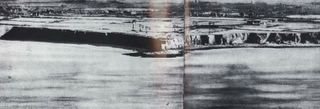
Reconaissance photo with Gun placements marked (click to enlarge)
And here is the Allies map of Pointe du Hoc. Notice it says 'Top Secret Bigot'. For the British their term for war secrets was Bigot. Any person to have clearance for secret war documents was said to be 'bigotted'.
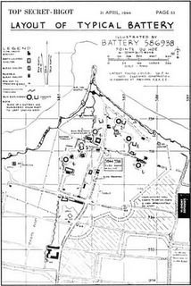
Secret Allied map of Ponte du Hoc
Here are the bombers over Pointe du Hoc with the smoke and dust from their bombs visible.

Bombing of Pointe du Hoc
The bomb damage was so extensive it is apparent today. The aerial photo below shows the extensive craters today. And it was that bombing that caused the Rangers so much frustration. The Germans in the days before the invasion moved the guns inland to prevent them from being damaged by more Allied bombing.

Aerial view of Pointe de Hoc
So the Rangers assualted the beach with many casualties, then scaled a cliff under rifle and grenade fire, took over the trenches only to find the guns gone.
Fortunately the guns were heavy enough to leave tracks and the Rangers followed the tracks inland where they were able to disable them and announce their mission completed, somewhat behind their schedule.

Pointe Du Hoc concrete jumble. Here Redington walks amidst the broken blocks of fortifications.
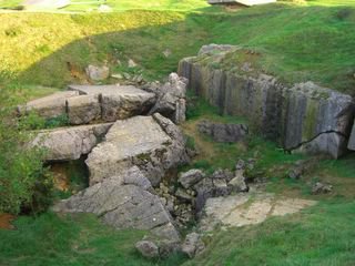
Direct hits often ruptured the reinforced concrete. In other places the concrete was intact when a bomb only fell next to the structure.

The Ranger's Memorial shaped like the Ranger's trademark dagger.
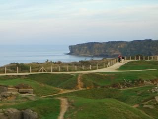
View from Pointe du Hoc

Looking back at the point the Ranger's assualted

Redington shows how big the bomb craters are.
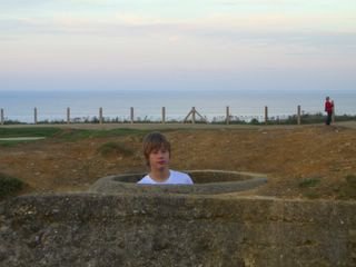
Redington in a Tobruk. Redington had read much about these fearsome defensive structures and was quite intrigued to actually see them. They were formidable. When you get inside you have a clear field of fire in all directions with a machine gun. You would be invulnerable to small arms attacks.

Looking out of a Casement

This is the same casement exhibiting bomb damage.

Sunset getting time to go home. By now our long day was over. We would not get to see Utah beach or what is left of the hedgerows like we hoped but we saw and experienced a great deal.
We drove back to the hotel at Abbeville and in the morning headed back to Calais. We looked at a map at breakfast and realized we were passing through the Somme. We decided then that there were ample opportunities to travel together in Europe using our interest in history as a guide. From Greece to the Romans to Napolean to the Great War and WWII we had a lot to look forward with Redington living in Europe.
By now I had learned of news from Lattice that they were closing the UK office and my chances of moving there. I left France with a heavy heart. A few days later I left the UK happy to see Redington. Gratified that he is doing well. Our affection for each other undiminished.

Leaving Pas de Calais

Heading back to the cliffs at Dover
In the weeks before the invasion bombers had dropped tons of ordinance on the location. Below is a reconaisance photo at the time with different guns highlighted.
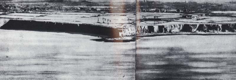
Reconaissance photo with Gun placements marked (click to enlarge)
And here is the Allies map of Pointe du Hoc. Notice it says 'Top Secret Bigot'. For the British their term for war secrets was Bigot. Any person to have clearance for secret war documents was said to be 'bigotted'.

Secret Allied map of Ponte du Hoc
Here are the bombers over Pointe du Hoc with the smoke and dust from their bombs visible.
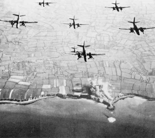
Bombing of Pointe du Hoc
The bomb damage was so extensive it is apparent today. The aerial photo below shows the extensive craters today. And it was that bombing that caused the Rangers so much frustration. The Germans in the days before the invasion moved the guns inland to prevent them from being damaged by more Allied bombing.

Aerial view of Pointe de Hoc
So the Rangers assualted the beach with many casualties, then scaled a cliff under rifle and grenade fire, took over the trenches only to find the guns gone.
Fortunately the guns were heavy enough to leave tracks and the Rangers followed the tracks inland where they were able to disable them and announce their mission completed, somewhat behind their schedule.
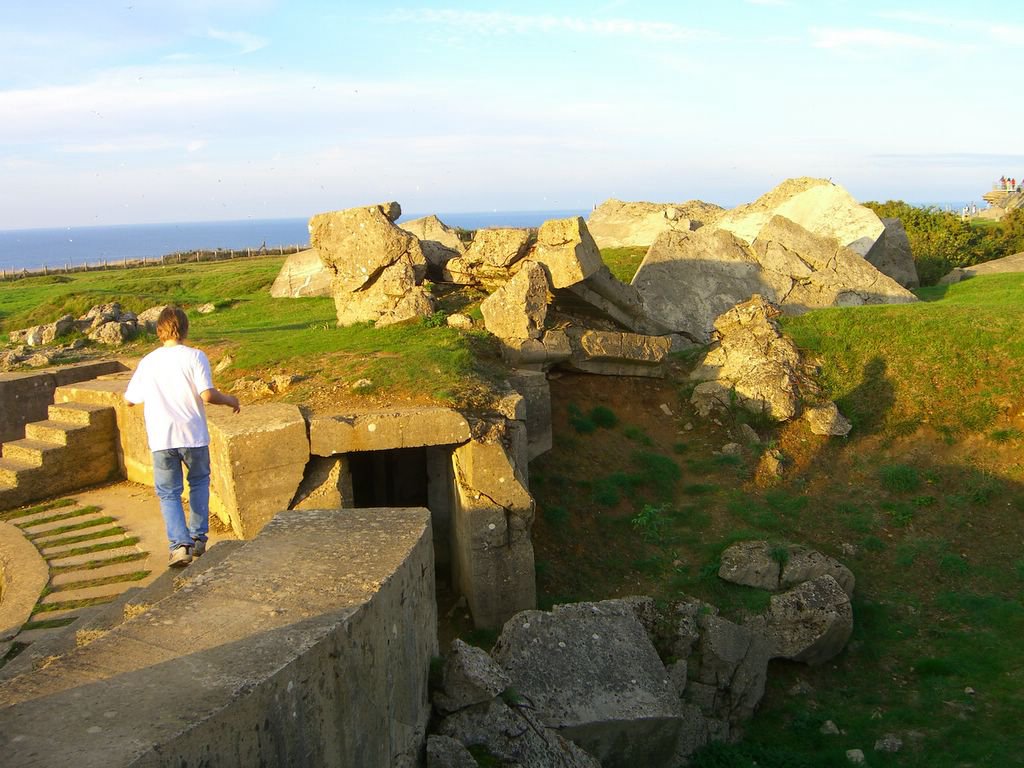
Pointe Du Hoc concrete jumble. Here Redington walks amidst the broken blocks of fortifications.
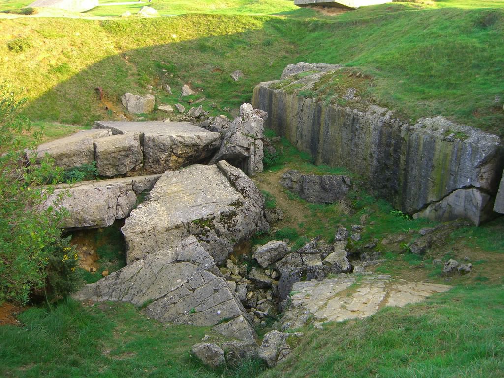
Direct hits often ruptured the reinforced concrete. In other places the concrete was intact when a bomb only fell next to the structure.

The Ranger's Memorial shaped like the Ranger's trademark dagger.

View from Pointe du Hoc
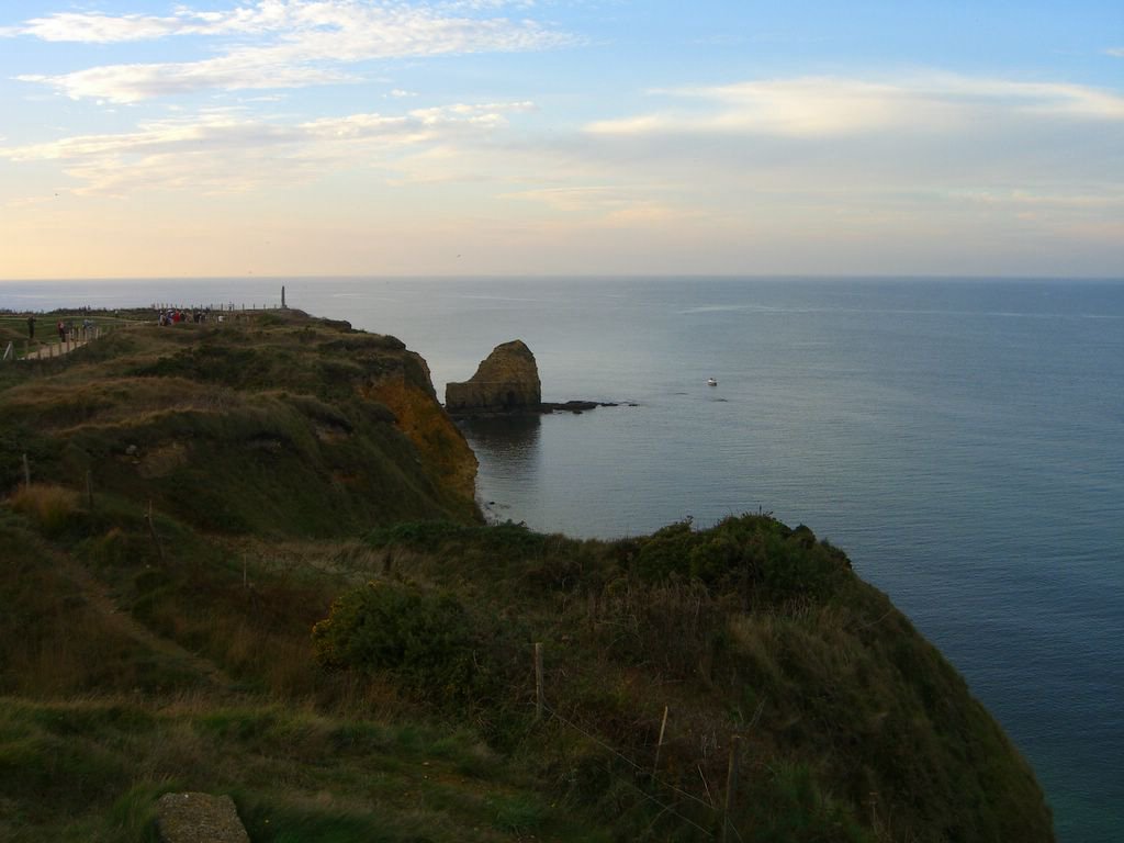
Looking back at the point the Ranger's assualted

Redington shows how big the bomb craters are.

Redington in a Tobruk. Redington had read much about these fearsome defensive structures and was quite intrigued to actually see them. They were formidable. When you get inside you have a clear field of fire in all directions with a machine gun. You would be invulnerable to small arms attacks.

Looking out of a Casement

This is the same casement exhibiting bomb damage.

Sunset getting time to go home. By now our long day was over. We would not get to see Utah beach or what is left of the hedgerows like we hoped but we saw and experienced a great deal.
We drove back to the hotel at Abbeville and in the morning headed back to Calais. We looked at a map at breakfast and realized we were passing through the Somme. We decided then that there were ample opportunities to travel together in Europe using our interest in history as a guide. From Greece to the Romans to Napolean to the Great War and WWII we had a lot to look forward with Redington living in Europe.
By now I had learned of news from Lattice that they were closing the UK office and my chances of moving there. I left France with a heavy heart. A few days later I left the UK happy to see Redington. Gratified that he is doing well. Our affection for each other undiminished.
Leaving Pas de Calais

Heading back to the cliffs at Dover
Comments
Looking forward!